


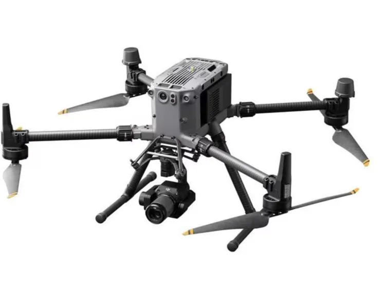
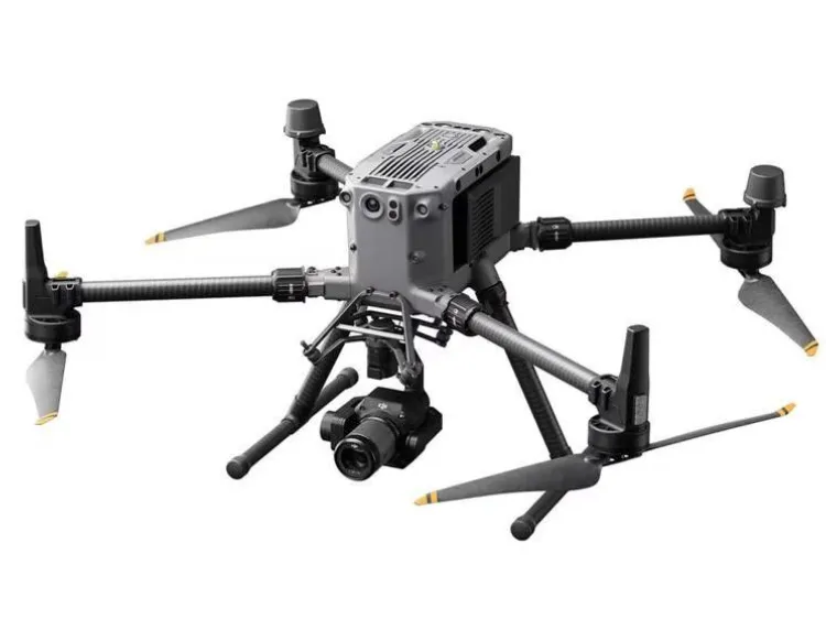


DJI inspection drone

- 0.2 mm layer height, 2‑wall walls, 15% infill density

1-disc
PLA
Designer

3

0
DJI Inspection Drones: Technological Innovation and Industry Transformation
## Chapter 1: Introduction—The Era of Drone-Based Inspections (Approx. 1,500 words) 1.1 Pain Points of Traditional Inspection Methods — Power Grid Inspection: High-Risk, Low-Efficiency Manual Checks of High-Voltage Towers — Infrastructure Monitoring: Visual Blind Spots in Bridge and Wind-Turbine Blade Inspections — Oil Pipeline Inspection: Costly Challenges of Manual Patrols in Remote Desert Areas
1.2 The Rise of Industrial Drones — Global Drone Market Growth Rate (Citing Frost & Sullivan Data) — DJI’s Strategic Deployment in Industry Applications — Notable Case: First Large-Scale Implementation by Yunnan Power Grid in 2015
## Chapter 2: Core Technologies of DJI Inspection Drones (Approx. 2,500 words) 2.1 Flight Platform Design Philosophy
Analysis of the Matrice 300 RTK’s IP45 Protection Rating — Advanced Battery Thermal Management for an Ultra-Long 55-Minute Endurance — Six-Axis Binocular Vision Plus Infrared Sensing Obstacle Avoidance System
2.2 Intelligent Inspection System Architecture — AI Path Planning in DJI Pilot 2.0 Control Software — Collaborative Control via the Cloud-Based FlightHub 2.0 Platform — Third-Party SDK Open Interfaces (e.g., Insulator Recognition Algorithms for the Power Industry)
2.3 Sensor Revolution — Technical Specifications of the Zenmuse H20T Multispectral Payload — Fusion of LiDAR L1 with Photogrammetry — Thermal Imaging Capabilities with Temperature Resolution as Fine as 0.1°C
## Chapter 3: In-Depth Analysis of Typical Application Scenarios (Approx. 3,000 words) 3.1 Transforming the Energy Sector — State Grid’s Three-Year Plan to Replace Manual Inspections with Drones — AI‑Driven Diagnosis Systems for Hotspot Detection on Solar Panels — Case Study: Automated Inspection Network at a Wind Farm in Inner Mongolia
3.2 Smart City Development — Shenzhen Housing and Urban–Rural Development Bureau’s Standards for Exterior Building Facade Inspections — DJI Mavic 3E’s Millimeter-Level Crack Detection on Bridges — SLAM Technology Applied to Underground Utility Tunnel Inspections
3.3 Emergency Response Systems — Grid Restoration Efforts During Henan Floods — Smoke Detection Algorithms for Forest Fire Prevention — Three-Dimensional Gas Leak Monitoring in Chemical Industrial Parks
## Chapter 4: Technical Challenges and Innovative Breakthroughs (Approx. 2,000 words) 4.1 Real-World Bottlenecks — Navigation Stability in Complex Electromagnetic Environments — Reliability Testing Under Extreme Weather Conditions (-20°C to 50°C) — Encrypted Data Transmission Solutions
4.2 DJI’s Solutions — Redundant Dual-Frequency RTK Positioning Design — Patented Self-Heating Battery Technology — Localized “Black Box” Data Processing System
## Chapter 5: Future Trends (Approx. 1,000 words) 5.1 Directions for Technological Convergence — Deep Integration with Digital Twins and BIM Systems — 5G‑Enabled Drone Swarm Coordination — Standardization of Autonomous Charging Platforms
5.2 Ecosystem Development — Open APIs Between DJI Terra and Third-Party Analytics Software — Establishment of Global Certification Frameworks (e.g., EU SORA Standards) — Vocational Training Programs for Drone Operators
## Sample Detailed Section (Excerpt from Chapter 3):
### 3.1 Transforming the Energy Sector According to the National Energy Administration’s 2021 “Technical Guidelines for Power Grid Drone Inspection,” DJI’s Matrice 300 RTK has been designated as the recommended model. Equipped with the Zenmuse P1 photogrammetric camera, it can generate high‑precision 3D models of 20 km of 500 kV transmission lines in a single flight, achieving centimeter-level accuracy. Test data from one provincial power grid indicate that tasks traditionally requiring five workers three days to complete can now be finished by a drone crew in just two hours, while defect detection rates have improved by 40%.
In the solar sector, DJI has partnered with LONGi Green Energy to develop an intelligent diagnostic system that combines visible-light and infrared multispectral scanning to automatically identify 12 types of faults, including hotspots and hidden cracks in solar panels. Following implementation at a 200 MW photovoltaic plant in Xinjiang, annual revenue losses were reduced by approximately RMB 2.7 million.
## Suggestions for Expansion: 1. Include specific case studies: select 3–5 representative user interviews 2. Add data visualizations: endurance comparison charts/inspection accuracy comparison graphs 3. Incorporate policy analysis: evolution of national airspace regulations 4. Elaborate technical details: provide a more thorough explanation of RTK positioning principles 5. Conduct economic feasibility analyses: ROI modeling frameworks
Originality of the Model
The author declares that this work is their personally original model
This model is licensed under the following terms:
Credit must be given to the creator
Remixes must be shared under the same license
Models(1)
- reduced_color_260720093047_AHOU.3mfDesigner

7.23 MB

2026-07-23


